Christopher Ridenour walked 244 miles of the Mason-Dixon Line in the summer of 2023, mostly the Pennsylvania-Maryland section, with a borrowed surveying instrument and a notebook. The book he wrote about the walk, The Walking Survey, was published by Graywolf Press in Minneapolis on 2026-06-11. It is 274 pages, plus an 18-page bibliography. The print run is 6,000.
Ridenour is fifty-three. He teaches geography at Shippensburg University in south-central Pennsylvania, eight miles from the line itself. He has published one previous book, a 2019 academic monograph on early American boundary surveys with the University of Virginia Press. The new book is his first for a trade audience.
The Mason-Dixon Line was surveyed between 1763 and 1767 by the English astronomers Charles Mason and Jeremiah Dixon, sent from London to settle a property dispute between the Penn and Calvert families. The line runs 233 miles westward from the Delaware River, plus a 36-mile southward jog at the eastern end. The original survey markers — limestone blocks shipped from England, set every mile — have been a subject of antiquarian interest for nearly two centuries.
Ridenour's project was to walk the entire Pennsylvania-Maryland portion and locate as many of the original 1760s stones as he could find. He gave himself sixty-three days, from 1 June to 2 August 2023, and he carried a 1903 transit instrument that the Smithsonian Institution lent him on the basis of his earlier book.
The book is organized as a series of daily entries. There are sixty-three of them, plus a brief preface and a fifteen-page closing essay. Each daily entry runs three to six pages.
The first ten days, walking westward from the Delaware River through Chester County, are the book's most conventional. Ridenour describes the suburban landscape east of Lancaster County, the housing developments that have grown up across the line in the last forty years, and the difficulty of finding the original 1760s stones beneath the asphalt.
On day eight, in Oxford, Pennsylvania, he locates the original stone marked "68 miles from the post," set in 1765 by Mason and Dixon themselves and embedded since 1972 in the parking lot of a Sunoco gas station. The stone is described in the daily entry with the kind of patient specificity the book sustains throughout.
The middle of the book, days fifteen through forty-five, walks the Lancaster, York, and Adams County stretches. This is the section where Ridenour's prose comes into its own. He is good company on a walk. He carries his instruments and his sandwich and his small folding camera, and he records the people he meets on the line.
These people are the book's real subject. On day twenty-three, in a soybean field east of Gettysburg, he meets a farmer named Earl Trostle who has been ploughing around the same original 1765 stone since 1974. Trostle, then seventy-eight, gives Ridenour an hour of his time and a glass of iced tea and a precise account of which neighbours have respected the boundary and which have not.
On day thirty-one, in the Antietam Creek valley, Ridenour meets a Civil War battlefield archaeologist named Erica Mortenson who is mapping the precise wartime use of the line as a Confederate-Union boundary. Mortenson gets six pages, including a long passage on the limestone fragments found in the creek bed that may be the remains of an 1860s stone removed by Confederate soldiers in June 1863.
Ridenour is not, in these encounters, a journalist. He is a geographer with the courtesy of a colleague, and the people he meets give him technical detail rather than personal narrative. The book is the better for this. It does not, like so many walking books, mistake its subjects for material.
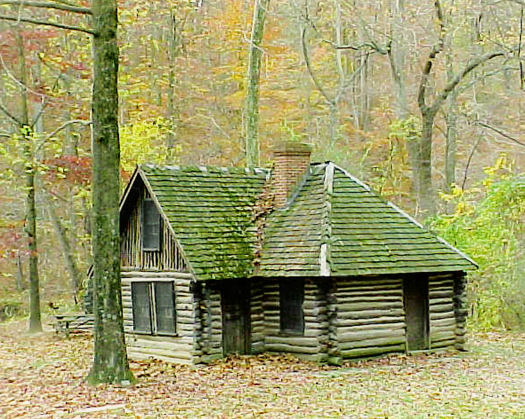
The western half of the book, days forty-six through sixty-three, is the most difficult walking. Ridenour crosses into the Allegheny ridge country of Bedford and Somerset counties, and the line begins to climb into the highlands. The original 1760s survey itself reached a hard stop at the western edge of Pennsylvania, against the western frontier of European-American settlement at the time, and the modern walker faces a landscape of small back roads, abandoned coal lands, and steep forested ridges.
Day fifty-seven, on Negro Mountain in the western Alleghenies, is the book's most reflective entry. The mountain takes its name from a Black man, otherwise unidentified, who died there in 1756 while fighting alongside Pennsylvania militia in a colonial skirmish. The renaming controversy of recent years — the 2022 effort by the Maryland legislature to rename the mountain — receives four pages in the entry.
Ridenour handles it carefully. He does not propose a solution. He records, in his characteristic way, what the official record shows, what the local people he meets say, and what the original 1760s survey notes — which he has read in the Pennsylvania Historical and Museum Commission archives — actually contain. The Mason and Dixon journals refer to the mountain only as "a small rising ridge" and do not name it.
The final days, walking to the western terminus at the original 1765 stone marking the southwest corner of Pennsylvania, are quieter. Ridenour finds the stone on day sixty-two, in a wooded clearing on land owned by the West Virginia Department of Natural Resources. He photographs it and sits with it for an hour and writes one of the book's shorter daily entries.
The book's closing essay, fifteen pages, is the only part of the book that does not quite work. Ridenour has tried to gather, in a single essay, his thoughts on what the line means in 2026. He is sometimes too cautious, sometimes too willing to summarize. The essay would have been better as four short essays scattered through the book, or as nothing at all.
Graywolf Press, which under Fiona McCrae and now Carmen Giménez has built one of the strongest independent non-fiction lists in the United States, has produced the book well. The cover, designed by the Minneapolis studio Wide Net, is a reproduction of a 1768 manuscript map of the line from the Maryland State Archives, in a single ochre ink on a cream ground.
The book is sewn. The type is Granjon at 11 on 14. There are twelve maps, drawn by the cartographer Sarah Bell of Pittsburgh, and the maps are essential. A reader without the maps would be lost by day twenty.
There are sixteen black and white photographs, all taken by Ridenour with his folding camera. They are not technically accomplished photographs. They are exactly the photographs a walking geographer with a folding camera would take. The book is better for not having professional photography.
The price is twenty-six dollars. The book deserves a wider readership than it will get. American non-fiction publishing in 2026 favors louder books — the political memoir, the celebrity essay, the climate jeremiad — and Ridenour's quiet account will be lost on the front tables of the chain stores.
It will, with luck, find its way into the hands of geographers, surveyors, walkers, local historians, and a small number of readers who simply enjoy the company of an intelligent person walking carefully through a landscape they know.
Those readers will be rewarded. The book is the best American walking non-fiction since Robert Sullivan's The Meadowlands in 1998. It is not as funny as Sullivan, and it is more academic in its references, but it shares with Sullivan the rarer virtue of having actually done the walk.
Ridenour will not write another book like this one. He told the audience at his book launch at the Midtown Scholar bookshop in Harrisburg, on 2026-06-12, that the sixty-three days of walking gave him a chronic foot injury that has not fully healed. His next book, he said, will be an indoor book about colonial American surveying instruments, written from his office at Shippensburg.
That book may be useful. This one is durable. It will sit, in a decade, on the shelf next to the small number of American walking books that have outlasted their season.